Let me go a little bit into what the flood did…
More than one hundred years ago, geologists began to ponder the landforms in eastern Washington State. They noticed that the land surface is essentially flat and underlain by thick and extensive basalt flows, with only a thin soil cover. They called this area a scabland. Geologists also observed a braided pattern of deep channels appearing as severely scrubbed bare rock surfaces eroded through the soil cover into the basalt bedrock. Most of these channels now dry and are called “coulees.” This 16,000-square-mile area of eastern Washington became known as the “Channeled Scabland.”
http://www.icr.org/article/2977/
The volcanic rock base (basalt) of the Scablands is seen on the map below:

https://fermi.jhuapl.edu/states/maps_bw/wa_bw.gif
The flood eroded to the basalt layer (Columbia River Basalt Group). The basalt layer is estimated between 17 million to 6 million years old.
http://vulcan.wr.usgs.gov/Volcanoes/Col … ateau.html
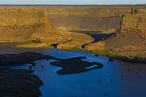
The flood eroded hundreds of feet of rock. Dry Falls has a 400 foot rock face which was eroded by the flood. (Niagara Falls has a drop of 165 feet)
http://en.wikipedia.org/wiki/Dry_Falls
A picture of Dry Falls:
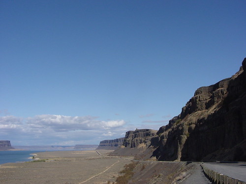
Grand Coulee Canyon, at 50 miles in length, and 1 to 5 miles across, is the largest of the channels gouged by a deluge.
http://www.gonorthwest.com/Washington/n … _Falls.htm
A picture of the Grand Coulee Canyon:
In total, the flood carved out 50 cubic miles of earth.
http://www.nps.gov/iceagefloods/d.htm
https://debatingchristianity.com/forum/viewtopic.php?p=85303#p85303